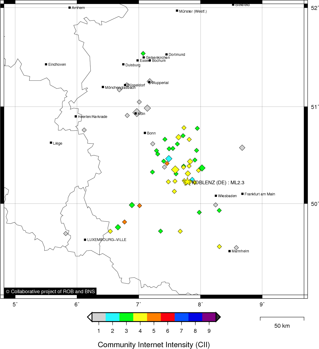
KOBLENZ (DE) - 2011-02-14 13:38:00
- Magnitude 2.3
Last update : 2016-11-24 12:10:27 Belgian time
Main parameters
| Date and time |
2011-02-14 13:38:00 UTC
2011-02-14 14:38:00 Belgian time |
| Type | Earthquake |
| Magnitude | ML 2.3 |
| Maximal intensity | IV |
| Region | KOBLENZ (DE) |
| Epicentral coordinates | 50.226° N, 7.789° E Uncertainty ± 10.0 km |
Data source : ROB (Royal Observatory of Belgium)
Location map
Quake measurements
Measurements by the Belgian seismic network
| Station | Epicentral distance (km) |
P-Wave arrival (hh:mm:ss.ss) | S-Wave arrival (hh:mm:ss.ss) | Maximal ground displacement (nm) |
|
|---|---|---|---|---|---|
| Code | Place | ||||
| VIA | VIANDEN | 118 | 13:38:54.36 | 13:39:10.61 | - |
| KLB | KALBORN | 121 | 13:38:56.32 | 13:39:10.39 | 16.2 |
| MEMS | MEMBACH | 133 | 13:38:57.14 | 13:39:12.39 | 25.3 |
| EBN | EBEN-EMAEL | 163 | 13:39:01.81 | 13:39:19.15 | - |
| CLA | CLAVIER | 178 | 13:39:04.27 | 13:39:23.36 | - |
Macroseismic
Data
| Total number of responses | 86 |
|---|---|
| Intensity I | 27 |
| Intensity II | 4 |
| Intensity III | 27 |
| Intensity IV | 21 |
| Intensity V | 7 |
Attention! The intensities derived from the macroseismic enquiry are raw unverified data.
Map
Data policy
Please read on this notice to learn more about our data policy.